U.S. President Barack Obama and Chinese President Xi Jinping look down during their news conference in the Great Hall of the People in Beijing.
Category Uncategorized
A North Korean national meeting at the April 25 House of Culture in Pyongyang
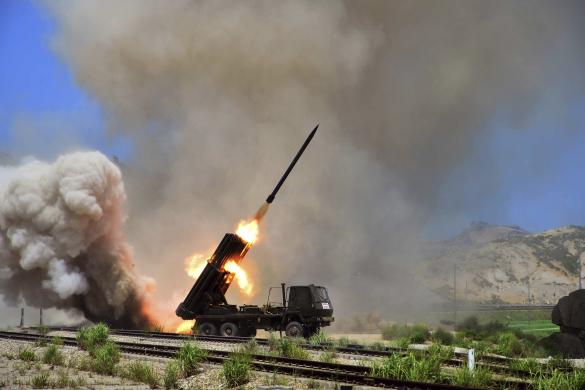
A view of a multiple rocket launcher during an exercise in North Korea
Fifa World Cup Brazil – Algeria makes history
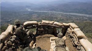
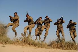
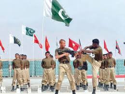
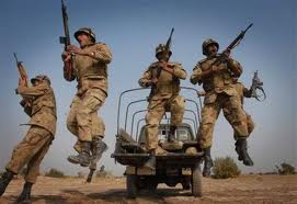
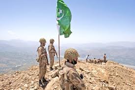
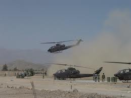
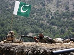
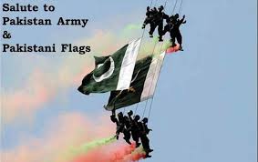
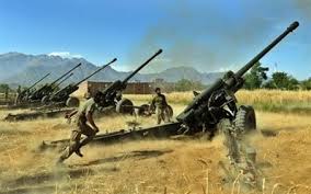
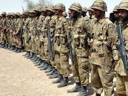
Pakistan Army in Action
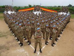
South Sudan: Thousands more affected by violence
History of Syria
Syria : سوریه, Sûrî), officially the Syrian Arab Republic, is a country in Western Asia, bordering Lebanon and the Mediterranean Sea to the West, Turkey to the north, Iraq to the east, Jordanto the south and Israel to the southwest. A country of fertile plains, high mountains and deserts, it is home to diverse ethnic and religious groups, including Kurds, Armenians, Assyrians, Turks, Christians, Druze, Alawite Shias and Arab Sunnis. The latter make up the majority of the population.
In English, the name “Syria” was formerly synonymous with the Levant (known in Arabic as al-Sham) while the modern state encompasses the sites of several ancient kingdoms and empires, including the Eblan civilization of the third millennium BC. In the Islamic era, its capital city,Damascus, the oldest continuously inhabited city in the world,[6] was the seat of the Umayyad Caliphate, and a provincial capital of the Mamluk Sultanate of Egypt. The modern Syrian state was established after the First World War as a French mandate, and represented the largest Arab state to emerge from the formerly Ottoman-ruled Arab Levant. It gained independence in April 1946, as a parliamentary republic. The post-independence period was tumultuous, and a large number of military coups and coup attempts shook the country in the period 1949–1971. Between 1958 and 1961, Syria entered a brief union with Egypt, which was terminated by a military coup. Syria was under Emergency Law from 1963 to 2011, effectively suspending most constitutional protections for citizens, and its system of government is considered to be non-democratic.[7] Bashar al-Assad has been president since 2000 and was preceded by his father Hafez al-Assad, who was in office from 1970 to 2000.[8]
Syria is a member of one International organization other than the United Nations, the Non-Aligned Movement; it is currently suspended from theArab League[9] and the Organisation of Islamic Cooperation,[10] and self suspended from the Union for the Mediterranean.[11]Since March 2011, Syria has been embroiled in civil war in the wake of uprisings (considered an extension of the Arab Spring, the mass movement of revolutions and protests in the Arab world) against Assad and the neo-Ba’athist government. An alternative government was formed by the opposition umbrella group, the Syrian National Coalition, in March 2012. Representatives of this government were subsequently invited to take up Syria’s seat at the Arab League.[12] The opposition coalition has been recognised as the “sole representative of the Syrian people” by several nations including the United States, United Kingdom and France.[13][14][15]
Etymology
The name Syria is derived from the ancient Greek name for Syrians: Σύριοι, Sýrioi, or Σύροι, Sýroi, which the Greeks applied without distinction to the Assyrians.[16][17] A number of modern scholars argued that the Greek word related to the cognate Ἀσσυρία, Assyria, ultimately derived from the Akkadian Aššur.[18] Others believed that it was derived from Siryon, the name that the Sidonians gave to Mount Hermon.[19] However, the discovery of the Çineköy inscription in 2000 seems to support the theory that the term Syria derives from Assyria.
The area designated by the word has changed over time. Classically, Syria lies at the eastern end of the Mediterranean, between Arabia to the south and Asia Minor to the north, stretching inland to include parts of Iraq, and having an uncertain border to the northeast that Pliny the Elderdescribes as including, from west to east, Commagene, Sophene, and Adiabene.[20]By Pliny’s time, however, this larger Syria had been divided into a number of provinces under the Roman Empire (but politically independent from each other): Judaea, later renamed Palaestina in AD 135 (the region corresponding to modern day Israel, the Palestinian Territories, and Jordan) in the extreme southwest, Phoenicia corresponding to Lebanon, with Damascena to the inland side of Phoenicia, Coele-Syria (or “Hollow Syria”) south of the Eleutheris river, and Iraq.[21]Since approximately 10,000 BC, Syria was one of centers of Neolithic culture (known as Pre-Pottery Neolithic A) where agriculture and cattle breeding appeared for the first time in the world. The following Neolithic period (PPNB) is represented by rectangular houses of Mureybet culture. At the time of the pre-pottery Neolithic, people used vessels made of stone, gyps and burnt lime (Vaiselles blanches). Finds of obsidian tools from Anatolia are evidences of early trade relations. Cities of Hamoukar and Emar played an important role during the late Neolithic and Bronze Age. Archaeologists have demonstrated that civilization in Syria was one of the most ancient on earth.
Around the excavated city of Ebla which is near present day Idlib in northern Syria, a great Semitic empire spread from the Red Sea north to Anatolia and east to Iraq from 2500 to 2400 BC. Ebla appears to have been founded around 3000 BC, and gradually built its empire through trade with the cities of Sumer andAkkad, as well as with peoples to the northwest.[22] Gifts from Pharaohs, found during excavations, confirm Ebla’s contact with Egypt. Scholars believe thelanguage of Ebla to be among the oldest known written Semitic languages, designated as Paleo-Canaanite.[22]However, more recent classifications of the Eblaite language have shown that it was an East Semitic language, closely related to the Akkadian language.[23] The Eblan civilization was likely conquered by Sargon of Akkad around 2260 BC; the city was restored, as the nation of the Amorites, a few centuries later, and flourished through the early second millennium BC until conquered by the Hittites.[24]
Related articles
- Syrian intervention: No desirable outcomes (ibnlive.in.com)
- Understanding Syria (ticktockthings.wordpress.com)
- SYRIA: Another IRAQ in the making? (salawurasaki.wordpress.com)
- Archbishop Atallah Hanna: Those who bear arms against Syria serve Israel (ramyabdeljabbar.wordpress.com)
Nigeria
Nigeria officially the Federal Republic of Nigeria, is a federal constitutional republic comprising 36 states and its Federal Capital Territory, Abuja. The country is located in West Africa and shares land borders with the Republic of Benin in the west, Chad and Cameroonin the east, and Niger in the north. Its coast in the south lies on the Gulf of Guinea on the Atlantic Ocean. There are over 500 ethnic groups in Nigeria of which the three largest ethnic groups are the Hausa, Igbo and Yoruba.
The name Nigeria was taken from the Niger River running through the country. This name was coined by Flora Shaw, who later married Baron Lugard, a British colonial administrator, in the late 19th century. The British colonised Nigeria in the late nineteenth and early twentieth century, setting up administrative structures and law while recognizing traditional chiefs. Nigeria became independent in 1960. Several years later, it had civil war as Biafra tried to establish independence. Military governments in times of crisis have alternated with democratically elected governments.
Nigeria, known as “the Giant of Africa”, is the most populous country in Africa and the seventh most populous country in the world.[6] Nigeria is roughly divided in half between Christians, who mostly live in the South and central parts of the country, and Muslims, concentrated mostly in the north. A minority of the population practice traditional and local religions, including the Igbo and Yoruba religions. Its oil reserves have brought great revenues to the country. It is listed among the “Next Eleven” economies. Nigeria is a member of both the Commonwealth of Nations, and theAfrican Union.
Independence
On 1 October 1960, Nigeria gained its independence from the United Kingdom. Nigeria’s government was a coalition of conservative parties: the Nigerian People’s Congress (NPC), a party dominated by Northerners and those of the Islamic faith; and the Igbo and Christian-dominated National Council of Nigeria and the Cameroons (NCNC) led by Nnamdi Azikiwe, who became Nigeria’s maiden Governor-General in 1960. Forming the opposition was the comparatively liberal Action Group (AG), which was largely dominated by the Yoruba and led by Obafemi Awolowo.[19]The cultural and political differences among Nigeria’s dominant ethnic groups: the Hausa (‘Northerners’), Igbo (‘Easterners’) and Yoruba (‘Westerners’), were sharp.
An imbalance was created in the polity by the result of the 1961 plebiscite. Southern Cameroon opted to join the Republic of Cameroon while northern Cameroon chose to remain in Nigeria. The northern part of the country was now far larger than the southern part. The nation parted with its British legacy in 1963 by declaring itself a Federal Republic, with Azikiwe as its first president. When elections were held in 1965, the Nigerian National Democratic Party came to power in Nigeria’s Western Region.
Civil War
The disequilibrium and perceived corruption of the electoral and political process led in 1966 to several back-to-back military coups. The first was in January and led by a collection of young leftists under Major Emmanuel Ifeajuna and Chukwuma Kaduna Nzeogwu. It was partially successful; the coup plotters murdered Prime Minister Abubakar Tafawa Balewa, Premier Ahmadu Bello of the Northern Region and Premier Ladoke Akintola of the Western Region. Despite this, they could not set up a central government. President Nwafor Orizu was then pressured to hand over government to the Nigeria Army, under the command of General JTU Aguyi-Ironsi.
The coup was counter-acted by another successful plot, supported primarily by Northern military officers and Northerners who favoured the NPC, it was engineered by Northern officers, which allowed Lt Colonel Yakubu Gowon to become head of state. This sequence of events led to an increase in ethnic tension and violence. The Northern coup, motivated by ethnic and religious reasons, resulted in the deaths of many military officers and civilians, especially those of Igbo descent.[citation needed]
The violence against the Igbo increased their desire for autonomy. By May 1967, the Eastern Region voted to declare independence as a state called the Republic of Biafra, under the leadership of Lt Colonel Emeka Ojukwu.[20] The Nigerian Civil War began as the Nigerian (Western and Northern) side attacked Biafra (South-eastern) on 6 July 1967 at Garkem. The 30 month war, with a long siege of Biafra and its isolation from trade and supplies, ended in January 1970.[21] Estimates of the number of dead in the former Eastern Region are between 1 and 3 million people, from warfare, disease, and starvation, during the 30-month civil war .[22]
Military Juntas
During the oil boom of the 1970s, Nigeria joined OPEC, and the huge revenue generated made the economy richer, although the military administration did nothing to improve the standard of living of the population, or to help the small and medium businesses, or even invest in the infrastructure. As oil revenues fueled the rise of federal subventions to states, the federal government became the centre of political struggle and the threshold of power in the country. As oil production and revenue rose, the Nigerian government created a dangerous situation as it became increasingly dependent on oil revenues and the international commodity markets for budgetary and economic concerns; it did not build economic stability. That spelled doom to federalism in Nigeria.[23]
Beginning in 1979, Nigerians participated in a brief return to democracy when Olusegun Obasanjo transferred power to the civilian regime of Shehu Shagari. The Shagari government became viewed as corrupt and incompetent by virtually all sectors of Nigerian society. The military coup of Muhammadu Buhari shortly after the regime’s fraudulent re-election in 1984 was generally viewed as a positive development by most of the population.[24] Buhari promised major reforms, but his government fared little better than its predecessor. His regime was overthrown by another military coup in 1985.[25]
Related articles
- Nigeria (humility6nigeria.wordpress.com)
- FEMI FANI KAYODE-Haunted By A Nupe Ancestry-Fighting A Foggy Yoruba Identity Complex (spyghana.com)
- Towards an Igbo governor of Lagos State (vanguardngr.com)
- Deportation: The Fani-Kayode Debate (vanguardngr.com)
African Lion Safari
 African Lion Safari is a family-owned safari park situated in Flamborough, Hamilton, Ontario, Canada, about 100 kilometres (62 mi) west ofToronto. The mailing address is in Cambridge, Ontario. It includes more than 1,000 animals, representing over 100 species of mammals and birds from across the globe. Guests may tour seven game reserves (with a total area of about 740 acres (300 hectares)) traversed via tour buses or the visitors’ own vehicles where animals roam freely in large contained areas. Accompanying the game reserves is a large walking section where hundreds of exotic birds and primates, as well as the park’s herd of Asian Elephants, are on display.
The African Lion Safari is an accredited member of the CAZA, and is also a member of the World Association of Zoos and Aquariums (WAZA), theInternational Elephant Foundation (IEF) and the International Association of Avian Trainers and Educators (IAATE).
African Lion Safari is open from the first weekend in May to the weekend of Canadian Thanksgiving in October. African Lion Safari has an on-site bus in which to tour the park, but public transportation to the park itself is limited.
History
The park was founded by Gordon Debenham “Don” Dailley, a retired Canadian Army colonel, and opened its doors on August 22, 1969. Dailley initially partnered with the Chipperfield family from England to purchase four farms in the Rockton, Ontario area totaling 250 hectares (620 acres). He bought out the Chipperfields in the early 1970s.[5] Dailley’s sons Don and James, along with their sister Ginny, took over operations in 1989, following their father’s death. It remains privately owned and operated.
The original size of the park was 80 hectares (200 acres), and the only significant feature was the drive-through reserve. In 1971 the park began working with Asian elephants, and in 1985 they started to make a concentrated effort to breed Asian elephants. Over the years successful breeding of 30 endangered species and 20 threatened species has occurred in the park. n any of the seven reserves, visitors are caged in their car and the animals roam in large enclosures that range from 2 to 20 hectares (4.9 to 49 acres).[1] Since the reserves are inhabited by wild animals all feeding is prohibited and visitors must keep doors and windows of their vehicles closed. Vehicles on which openings cannot be closed or where safety is otherwise compromised (for instance, by large cracks in the windshield) will not be allowed into the reserves. Visitors can always see the reserves via the air-conditioned tour buses. Since the potential for damage to vehicles from the animals exists, a slip road is provided for all guests who wish to avoid the monkeys and any potential damage to their vehicles.
Related articles
- Two Lions and a Tiger Die of Poisoning in Jambi Zoo (thejakartaglobe.com)
- The Story of Jenna (runningwithautism.com)
- I Totally Love Summer Because… (mydiaryentry.com)
- The Cons of African Safari Lion Hunts (carbonfairy.wordpress.com)
Bamako Grand Mosque
Bamako Grand Mosque is a mosque in the city centre of Bamako, Mali. Built on the site of a pre-colonial mud-brick mosque, the current Mosque was built through funding from the Saudi Arabian government at the end of the 1970s. One of the tallest structures in Bamako, the Mosque is situated north of the Niger River near the central Market (Grand Marche) and the colonial era Bamako Cathedral. With its tall cement Minarets built around a square central structure, the building is stylistically closer to Saudi religious structures than West African,[1] the Mosque is visible from much of the city and occasionally is opened to tourists.


